Data Mapping & Visualization

Announcing the Waypoints GIS Connector

By |January 5th, 2023|

Stellar Services, Arup and Moonshadow team up to address an urgent need

Departments of Transportation (DOTs) maintain their road network information in GIS systems. Connected Vehicle (CV) data gives us detailed information on how the road network is used. DOTs, therefore, have a need to combine road usage information from CV data with the road network information in their GIS system.

Arup used data from Michelin to visualize the congestion resulting from a Citi Field Mets game inside of ArcGIS over time

As vehicles are driving they send an update to the cloud every few seconds to generate a sequence of ‘breadcrumbs’ or […]

Introducing Arterial Insights

By |May 12th, 2021|

DKS Associates and Moonshadow Mobile are introducing Arterial Insights: an online tool to measure the performance of traffic corridors and signalized intersections using connected vehicle (CV) data from tens of millions of vehicles.

Fig. 1. Segment Travel Times per Hour in Arterial Insights

It can be time consuming and expensive to measure the efficiency of a signal timing plan for a corridor for example.  Up to now travel times, speeds and delays were measured by installing equipment at intersections, or by performing ‘floating car runs’.  Maintaining yet another group of devices in the field can be challenging and expensive whereas floating car […]

DB4IoT with INRIX for transportation emission analysis

By |May 10th, 2021|

The Eastern Research Group (ERG) studied the usefulness of using vehicle telematics data to create vehicle emission inventories. The study has been published by the Coordinated Research Council, Inc (CRC).

ERG surveyed several data sets and analytics platforms and vetted them before embarking on a more detailed study. They selected three sources, these included Moonshadow Mobile’s DB4IoT Platform with INRIX data, StreetLight Data’s Insight platform and Otonomo data.

Data from StreetLight were used to estimate total Vehicle Miles Traveled (VMT) within their study area. The study area was the 10-county Denver metro area. ERG verified StreetLight algorithm for scaling up telematics […]

Introducing Moonshadow Live Traffic

By |July 31st, 2020|

Moonshadow Mobile, Inc. has developed Moonshadow Live Traffic, powered by Wejo Ltd’s real-time connected car data, to give traffic managers access to maps that show the traffic situation for any area in the US with a latency of 30 seconds or less. 

Moonshadow Live Traffic is a break-through in both speed and accuracy for real-time traffic data by using Wejo connected vehicle data from over 10 million vehicles in the US.  The Michigan Department of Transportation (MDOT) recently issued an RFP that includes some key performance indicators (KPI’s) for real-time traffic data.  Moonshadow Live Traffic beats most KPI’s by a factor […]

Introducing DB4IoT with wejo Journeys

By |June 17th, 2020|

Wejo organizes billions of waypoints every day

Moonshadow Mobile, Inc. and Wejo Ltd, have teamed up to offer DB4IoT with wejo journey data.  Wejo is the trusted connected car data partner for global OEMs, with 14 million active passenger vehicles on its platform that generate 17 billion waypoints every day.  On May 20, wejo introduced Moonshadow as the first wejo Data Insight Partner in the world in a webinar.  A video of the webinar can be viewed here:

Fig 1. DB4IoT with Wejo data is available for any area in the US

DB4IoT with Wejo journey data is provided as a Platform as a […]

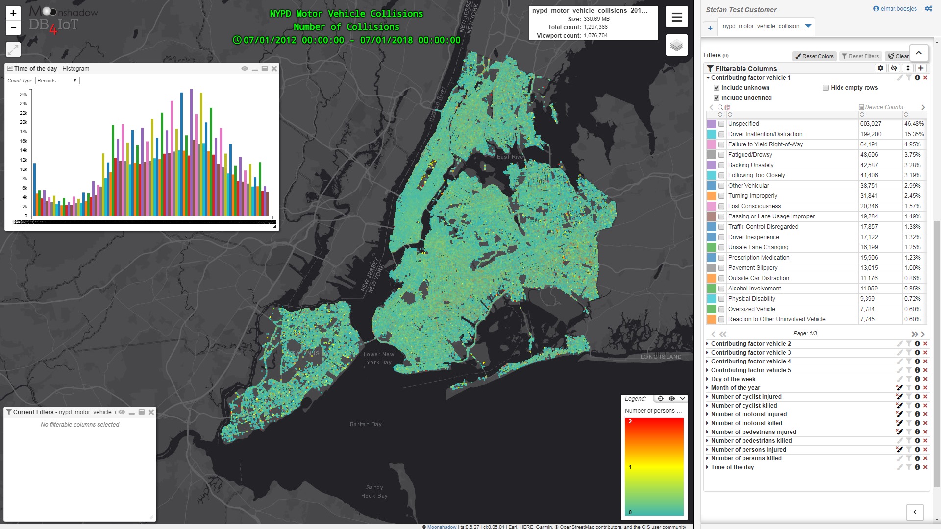
NYPD Open Data: Motor Vehicle Collisions Analytics in DB4IoT

By |April 10th, 2019|

The NYC Open Data portal provides an interesting and useful data set from the NYPD that is a breakdown of every collision in NYC by location and injury. This data is manually run every month and reviewed by the TrafficStat Unit before being posted on the NYPD website. Each record represents a collision in NYC by city, borough, precinct and cross street. This data can be used by the public to see how dangerous/safe intersections are in NYC.

We imported the data into DB4IoT, our time-series database engine and analytics platform for the Internet of Moving Things, to visualize the six-year […]